using GMT
resetGMT()  # hide
G = worldrectangular("@earth_relief_10m");
viz(G)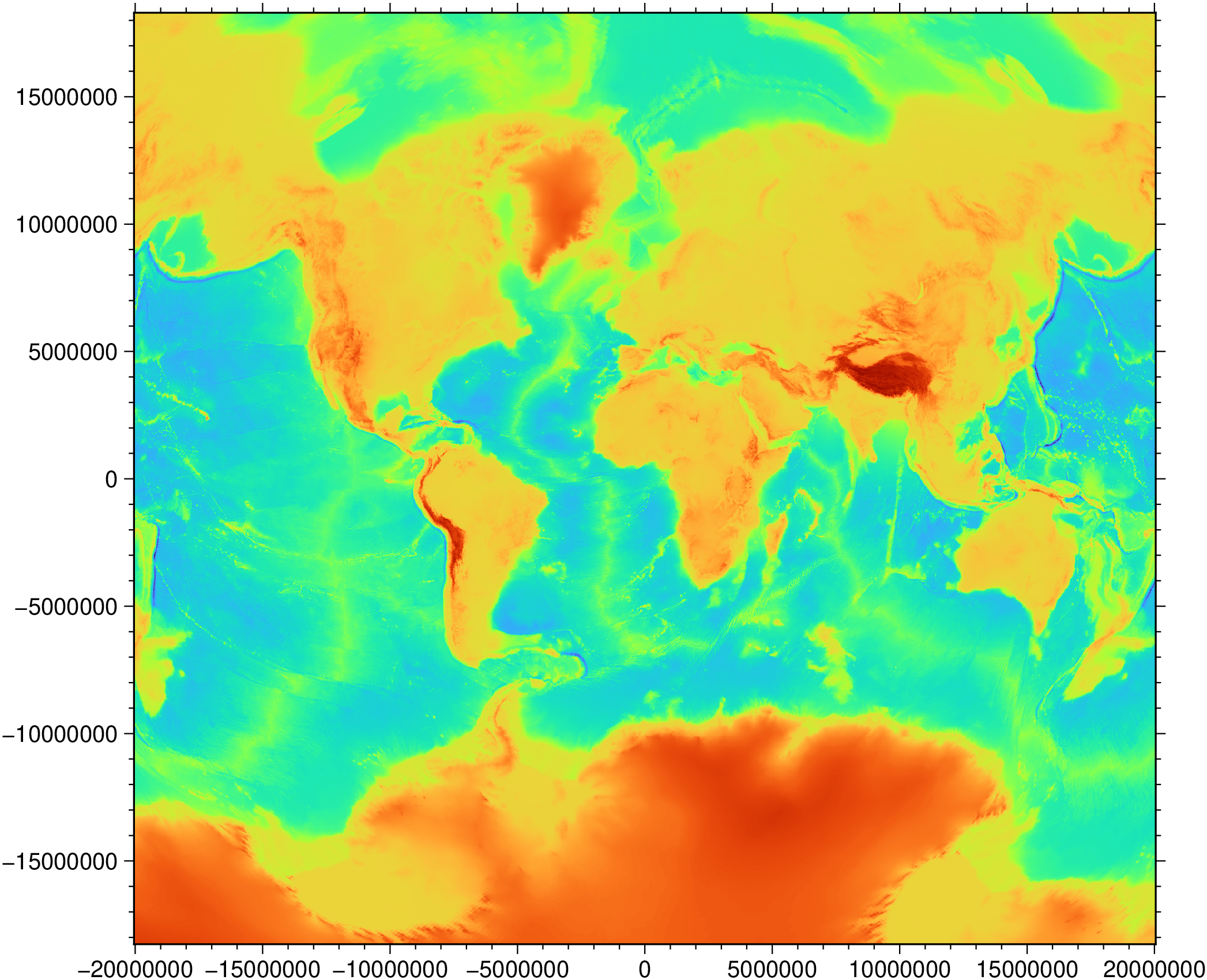
GI[,coast] = worldrectangular(fname::String|GI::GItype; proj::String="+proj=vandg", pm=0, latlim=:auto, coast=false)Try to create a rectangular map out miscellaneous and not cylindrical projections. We say try because only some projections are supported and those depend on the GDAL version. So a (slow) moving target.
GI: A GMTgrid or GMTimage data type. GI can also be a string with a file name of a grid or image.
proj: A PROJ4 string describing the projection.
pm: The projection prime meridian (Default is 0).
latlim or latlims: Latitude(s) at which the rectangular map is trimmed. The default (:auto) means that we will try to trim such that we get a fully filled grid/image. Use latlim=(lat_s,lat_n) or latlim=lat to make it equivalent to latlim=(-lat,lat).
coast: Return also the coastlines projected with proj. Pass coast=res, where res is one of GMT coastline resolutions (e.g. :crude, :low, :intermediate). coast=true is <==> coast=:crude Pass coast=D, where D is vector of GMTdataset containing coastline polygons with a provenience other than the GSHHG GMT database.
A grid or a image and optionally the coastlines … or errors. Not many projections support the procedure implemented in this function. The working or not is controlled by PROJ’s +over option
using GMT
resetGMT() # hide
G = worldrectangular("@earth_relief_10m");
viz(G)
coastlinesproj, graticules, leepacific, [plotgrid!], worldrectgrid, worldrectcoast, [Best rectangular world map projection]
This function has multiple methods:
worldrectangular(fname::String; proj, pm, latlim, latlims, pad, coast) - utils_project.jl:71worldrectangular(GI::GItype; proj, pm, latlim, latlims, pad, coast) - utils_project.jl:73